
Maritime Boundary Disputes Explained: UNCLOS Rules and Peaceful Settlement
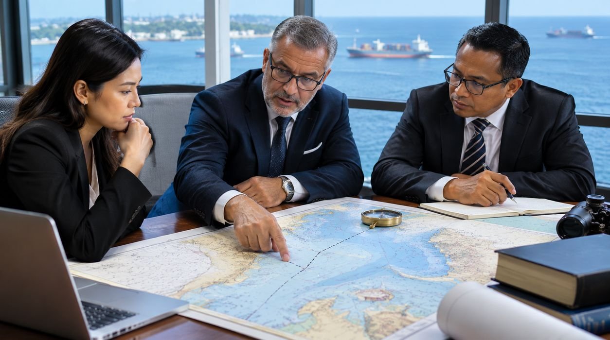
Two neighboring countries may share a coastline, depend on the same fishing grounds, and operate ships through nearby waters. But what happens when both governments claim rights over the same stretch of ocean?
The disagreement can affect fishing communities, offshore energy projects, international shipping, and diplomatic relationships.
These conflicts are known as maritime boundary disputes, and international law provides several methods for resolving them peacefully.
The United Nations Convention on the Law of the Sea (UNCLOS) establishes the principal legal framework for maritime zones, coastal-state rights, and maritime delimitation.
However, drawing a boundary is not always as simple as measuring equal distances from two coastlines.
Coastal geography, islands, overlapping claims, and relevant legal circumstances can significantly influence the outcome.
This guide explains maritime boundary disputes in 2026, the UNCLOS rules governing territorial seas and exclusive economic zones, and how international courts and arbitration tribunals resolve disagreements.
What Is a Maritime Boundary Dispute?
A maritime boundary dispute occurs when two or more countries disagree about the location of a boundary separating their maritime entitlements.
These disagreements usually arise when neighboring or opposite coastlines generate overlapping claims.
For example, two countries separated by a relatively narrow sea may each claim an exclusive economic zone extending up to 200 nautical miles from their baselines.
Because the distance between their coasts is insufficient to accommodate both full claims, a boundary must be established.
Disputes may involve:
- Territorial sea boundaries.
- Exclusive economic zone boundaries.
- Continental shelf delimitation.
- Islands and maritime entitlements.
- Offshore oil and gas resources.
- Fishing rights and marine resources.
A maritime boundary dispute is different from a dispute about ownership of land territory, although the two issues can be closely connected.
International law provides mechanisms for addressing these disagreements without resorting to force.
What Is UNCLOS?
The United Nations Convention on the Law of the Sea is a comprehensive international treaty governing the legal framework for oceans and maritime activities.
It was opened for signature on December 10, 1982, in Montego Bay, Jamaica, and entered into force on November 16, 1994.
UNCLOS establishes rules concerning maritime zones, navigation, marine resources, environmental protection, and dispute settlement.
The Convention also provides principles for determining maritime boundaries between countries.
According to the United Nations’ official UNCLOS text, several provisions specifically address the delimitation of overlapping maritime entitlements.
These include Articles 15, 74, and 83.
UNCLOS does not automatically resolve every territorial or maritime disagreement. Instead, it provides legal standards and procedures that states can use.
Understanding Maritime Zones Under UNCLOS
Before examining boundary disputes, it is important to understand the maritime zones recognized under international law.
Each zone gives coastal states different rights and responsibilities.
Territorial Sea: Up to 12 Nautical Miles
Under Article 3 of UNCLOS, a coastal state may establish a territorial sea extending up to 12 nautical miles from its lawful baselines.
The coastal state exercises sovereignty over its territorial sea, subject to UNCLOS and other applicable international law.
This sovereignty also extends to the airspace above the territorial sea and its seabed and subsoil.
However, foreign vessels generally enjoy the right of innocent passage under the applicable rules.
Contiguous Zone: Up to 24 Nautical Miles
The contiguous zone may extend up to 24 nautical miles from the baselines.
Within this zone, a coastal state may exercise specified controls to prevent or punish infringements of its customs, fiscal, immigration, and sanitary laws within its territory or territorial sea.
The contiguous zone is not equivalent to the territorial sea.
It does not provide unrestricted sovereignty over all activities occurring within the area.
Exclusive Economic Zone: Up to 200 Nautical Miles
An exclusive economic zone, commonly called an EEZ, may extend up to 200 nautical miles from the baselines.
Within the EEZ, the coastal state has sovereign rights concerning the exploration, exploitation, conservation, and management of natural resources.
These rights cover resources in the waters, seabed, and subsoil.
The coastal state also exercises specified jurisdiction concerning matters such as marine scientific research and environmental protection.
Other states retain important navigation and overflight freedoms, subject to the Convention.
Continental Shelf
The continental shelf concerns the seabed and subsoil beyond the territorial sea.
Coastal states possess sovereign rights to explore and exploit its natural resources.
Under UNCLOS, continental shelf entitlements may extend beyond 200 nautical miles where the relevant legal and geological conditions are satisfied.
The outer limits of a continental shelf and the delimitation of overlapping continental shelf entitlements are distinct legal questions.
UNCLOS Article 15: Territorial Sea Boundaries
Article 15 addresses territorial sea delimitation between states with opposite or adjacent coasts.
Where the countries have not agreed otherwise, the provision generally uses a median line based on equal distance from the relevant baselines.
However, the rule contains important qualifications.
Historic title or other special circumstances may justify a different boundary.
What is the median line?
A median line is a line whose points are equally distant from the nearest relevant baseline points of the two coastal states.
Imagine two countries facing each other across a narrow channel.
A line running approximately halfway between their coastlines may provide an initial boundary.
But unusual coastal geography, historic title, or other special circumstances can affect the legal outcome.
Therefore, equal distance is not always the final answer.
UNCLOS Article 74: Exclusive Economic Zone Delimitation
Article 74 governs EEZ delimitation between states with opposite or adjacent coasts.
Unlike Article 15, it does not prescribe a simple mandatory median-line formula.
Instead, delimitation must be achieved by agreement on the basis of international law to reach an equitable solution.
What does an equitable solution mean?
An equitable solution is a legally justified outcome that accounts for relevant circumstances.
It does not necessarily mean dividing every disputed area into two equal portions.
International courts and tribunals frequently use a structured approach involving provisional equidistance, consideration of relevant circumstances, and a disproportionality check.
The precise method depends on the geography and legal circumstances of the dispute.
Temporary arrangements
Article 74 also encourages states to make provisional arrangements of a practical nature while final delimitation remains unresolved.
Such arrangements should not prejudice the eventual boundary.
This can help neighboring countries cooperate over fisheries or resource management without settling every legal disagreement immediately.
UNCLOS Article 83: Continental Shelf Delimitation
Article 83 governs continental shelf boundaries between states with opposite or adjacent coasts.
Like Article 74, it requires delimitation by agreement on the basis of international law to achieve an equitable solution.
Continental shelf disputes can be especially important where valuable oil, natural gas, or seabed resources may exist.
Why continental shelf boundaries matter
A coastal state has sovereign rights over the exploration and exploitation of natural resources of its continental shelf.
When two countries claim overlapping seabed areas, uncertainty can complicate offshore exploration and licensing.
Resolving the boundary can provide greater legal certainty for resource development.
Articles 74 and 83 also address practical arrangements pending agreement and the need to avoid jeopardizing or hampering a final settlement.
How Are Maritime Boundaries Calculated?
International courts and tribunals often use a three-stage methodology for EEZ and continental shelf delimitation.
Stage 1: Draw a provisional equidistance line
The tribunal identifies relevant coasts and base points, then constructs a provisional equidistance line where appropriate.
Stage 2: Consider relevant circumstances
The tribunal examines whether particular geographic circumstances justify adjusting the provisional line.
These may include significant coastal concavity or the potentially disproportionate effect of particular islands.
Stage 3: Check for disproportionality
The tribunal assesses whether the resulting allocation creates a marked disproportion between the relevant coastal lengths and maritime areas.
This is a final reasonableness check, not a requirement to divide the disputed waters according to an exact mathematical ratio.
The methodology is particularly important because coastal geography varies substantially around the world.
Why Do Islands Cause Maritime Boundary Disputes?
Islands can complicate maritime delimitation because they may generate maritime entitlements.
Under Article 121 of UNCLOS, an island is a naturally formed area of land surrounded by water that remains above water at high tide.
However, Article 121(3) provides that rocks unable to sustain human habitation or economic life of their own do not have an EEZ or continental shelf.
Island sovereignty versus maritime entitlement
Two separate questions may arise.
First, which country has sovereignty over the island?
Second, what maritime entitlements does that feature generate?
A court deciding maritime delimitation does not automatically have jurisdiction to resolve an underlying land sovereignty dispute.
The legal treatment of islands also depends on the circumstances of the particular case.
An island may generate an entitlement without necessarily receiving full effect when a boundary between overlapping claims is drawn.
Why Are Maritime Boundaries Economically Important?
Maritime boundaries can influence access to important economic resources.
Fishing resources
Coastal communities may depend on fishing grounds near disputed waters.
Uncertainty can create difficulties for licensing, conservation, and enforcement.
Offshore oil and gas
Potential hydrocarbon deposits can make maritime delimitation economically significant.
Companies may hesitate to invest where competing governments claim authority.
Shipping and navigation
Boundary disputes can contribute to diplomatic tensions affecting maritime operations.
However, EEZ boundaries do not eliminate navigation freedoms recognized under international law.
Renewable energy
Offshore wind projects and other marine energy activities may require clarity concerning jurisdiction and resource rights.
Marine environmental protection
Neighboring countries may need to coordinate environmental management and conservation measures.
These economic and environmental interests help explain why peaceful settlement is important.
How Does UNCLOS Require Peaceful Settlement?
Part XV of UNCLOS establishes procedures concerning disputes about the interpretation or application of the Convention.
Article 279 requires states parties to settle such disputes by peaceful means.
Article 280 recognizes their freedom to agree on peaceful methods of their own choosing.
These provisions reflect the broader international legal principle that disputes should be addressed without unlawful threats or force.
The United Nations’ official UNCLOS dispute settlement provisions explain the available procedures and their limitations.
Negotiation
Direct negotiation is often the first method used.
Governments exchange legal positions, technical data, and proposed boundary coordinates.
Negotiations can produce bilateral maritime boundary agreements.
Mediation and conciliation
Third parties may assist countries in finding a mutually acceptable solution.
Conciliation can help clarify disagreements and recommend possible settlements.
International adjudication
Where jurisdictional requirements are satisfied, disputes may be submitted to an international court or tribunal.
These proceedings can result in binding decisions.
What Is the International Tribunal for the Law of the Sea?
The International Tribunal for the Law of the Sea, or ITLOS, is a judicial body established under UNCLOS.
It is based in Hamburg, Germany.
The Tribunal hears disputes within its jurisdiction concerning the interpretation or application of the Convention and certain related matters.
ITLOS can address maritime delimitation where the relevant jurisdictional conditions are satisfied.
Does ITLOS automatically hear every maritime dispute?
No.
Jurisdiction depends on the applicable treaty provisions, declarations, agreements, and other legal conditions.
Countries do not automatically submit every maritime boundary disagreement to ITLOS merely because they are parties to UNCLOS.
The Tribunal’s judgments are binding on the parties in cases where it properly exercises jurisdiction.
UNCLOS Article 287: Choosing a Dispute Settlement Procedure
Article 287 identifies four principal procedures for binding dispute settlement.
These are:
- The International Tribunal for the Law of the Sea.
- The International Court of Justice.
- Arbitration under Annex VII.
- Special arbitration under Annex VIII for specified categories.
States may make declarations selecting one or more procedures.
Where the parties have not accepted the same procedure, Annex VII arbitration generally operates as the default mechanism, subject to the Convention’s requirements and exceptions.
This system provides flexibility while establishing a framework for dispute settlement.
UNCLOS Article 298: Important Exceptions
Not every maritime delimitation dispute can automatically proceed to compulsory binding adjudication.
Article 298 allows states to declare optional exceptions covering specified categories of disputes.
These can include maritime boundary delimitation under Articles 15, 74, and 83.
A qualifying declaration may exclude certain disputes from compulsory binding procedures under Part XV, Section 2.
However, Article 298 also establishes conditions under which compulsory conciliation may apply to particular delimitation disputes.
The detailed requirements matter.
For example, disputes necessarily involving unresolved sovereignty over land territory may fall outside the relevant compulsory conciliation mechanism.
Therefore, whether a court or tribunal can hear a particular case requires careful examination of the parties’ legal positions and applicable declarations.
Bangladesh–Myanmar Maritime Boundary Case
The Bangladesh–Myanmar dispute provides a significant example of peaceful maritime delimitation.
The two countries disagreed about their maritime boundary in the Bay of Bengal.
Their dispute involved the territorial sea, exclusive economic zone, and continental shelf.
The parties accepted ITLOS jurisdiction for the dispute.
On March 14, 2012, ITLOS delivered its judgment.
The Tribunal addressed the boundary and important questions concerning continental shelf delimitation beyond 200 nautical miles.
The case demonstrated how international adjudication can resolve a complex disagreement involving overlapping maritime claims.
It also contributed to the development of international maritime delimitation jurisprudence.
Bangladesh–India Maritime Boundary Arbitration
Another important example involved Bangladesh and India.
The dispute concerned maritime boundaries in the Bay of Bengal.
An arbitral tribunal was constituted under Annex VII of UNCLOS.
On July 7, 2014, the tribunal issued its award.
The decision established the maritime boundary between Bangladesh and India in the territorial sea, EEZ, and continental shelf, including relevant areas beyond 200 nautical miles.
The Permanent Court of Arbitration’s official case announcement confirms the award and its scope.
This case illustrates the importance of arbitration when neighboring countries cannot settle their maritime boundaries through negotiation.
Together, the Bangladesh–Myanmar and Bangladesh–India cases show how legal proceedings can provide greater certainty over maritime entitlements.
Can Countries Use Force Over Maritime Boundaries?
Maritime disputes can generate serious political and security tensions.
However, the United Nations Charter establishes restrictions on the threat or use of force in international relations.
UNCLOS also requires peaceful settlement of disputes concerning its interpretation or application.
A disagreement about offshore resources does not automatically justify military action.
States should pursue lawful diplomatic and legal mechanisms.
The importance of legal limits during armed conflict is discussed in our Geneva Conventions guide.
The Geneva Conventions govern humanitarian protections during armed conflict, rather than ordinary maritime delimitation, but they illustrate the wider role of international law in limiting harmful conduct.
What Happens While a Maritime Dispute Remains Unresolved?
A maritime dispute may remain unresolved for years.
During that period, countries may continue negotiations or establish temporary cooperative arrangements.
Under Articles 74 and 83, states are expected to make efforts toward practical provisional arrangements and avoid jeopardizing or hampering final agreement.
Possible arrangements may involve fisheries cooperation, joint resource management, or technical coordination.
Such arrangements do not necessarily establish a permanent maritime boundary.
Their legal terms must be evaluated carefully.
The broader importance of resolving disagreements through established legal procedures is also discussed in The Importance of Law in Society.
How Do Courts Use Evidence in Maritime Boundary Cases?
Maritime delimitation cases often involve extensive technical and historical evidence.
Relevant materials may include:
- Official nautical charts.
- Geographic coordinates.
- Coastal surveys.
- Historical agreements.
- Treaty declarations.
- Technical reports.
- Expert geographic analysis.
- Records of diplomatic negotiations.
Courts assess the relevance and legal significance of the evidence.
Modern geographic information systems may help visualize competing boundary proposals.
However, technical maps do not replace legal analysis.
For a broader discussion of how information is collected and assessed across jurisdictions, see our article on cross-border electronic evidence.
The rules for criminal electronic evidence differ from maritime boundary proceedings, but both require reliable documentation and lawful procedures.
Maritime Boundaries and International Business
Boundary disputes can also affect companies involved in shipping, energy, fishing, and offshore infrastructure.
Businesses may face uncertainty over licensing, regulatory jurisdiction, and contractual obligations.
For example, an offshore exploration company must understand which government has authority to issue permits in a particular maritime area.
A disputed boundary may create legal and commercial risks.
International contracts should address applicable law, regulatory approvals, and dispute-resolution procedures.
Our guide to cross-border digital trade laws explains related international contract and jurisdiction issues in the digital economy.
Although the commercial activities differ, both subjects demonstrate why international businesses must understand overlapping legal systems.
International Cooperation and Modern Maritime Security
Maritime boundary agreements can support regional stability.
Clearer jurisdictional arrangements may help governments coordinate fisheries enforcement, resource management, and environmental protection.
However, boundary settlement does not resolve every maritime security problem.
Illegal fishing, piracy, trafficking, and other unlawful activities may require separate legal and operational responses.
International cooperation remains important.
For readers interested in the development of international cooperation against cross-border offenses, our UN Cybercrime Convention 2026 guide examines a different treaty framework.
Both areas show how international agreements can facilitate cooperation while respecting national jurisdiction.
Frequently Asked Questions
What is a maritime boundary dispute?
It is a disagreement between countries concerning the location of a boundary separating overlapping maritime entitlements.
What does UNCLOS stand for?
UNCLOS stands for the United Nations Convention on the Law of the Sea.
How far does a country’s territorial sea extend?
A coastal state may establish a territorial sea extending up to 12 nautical miles from its lawful baselines.
What is an exclusive economic zone?
An EEZ is a maritime zone extending up to 200 nautical miles from baselines, within which coastal states possess specified resource-related rights and jurisdiction.
What is maritime delimitation?
Maritime delimitation is the legal process of establishing boundaries between overlapping maritime entitlements.
Does UNCLOS require every boundary to follow the median line?
No. Article 15 establishes a median-line rule with exceptions for territorial seas, while Articles 74 and 83 require equitable solutions for EEZ and continental shelf delimitation.
Can ITLOS settle maritime boundary disputes?
Yes, when the Tribunal has jurisdiction over the dispute.
What is Annex VII arbitration?
It is an arbitration mechanism established under UNCLOS for certain disputes concerning the Convention’s interpretation or application.
Can countries refuse compulsory maritime delimitation proceedings?
Certain declarations under Article 298 can exclude specified disputes from compulsory binding procedures, subject to applicable conditions.
How was the Bangladesh–Myanmar maritime dispute resolved?
ITLOS delivered a judgment on March 14, 2012, delimiting the maritime boundary in the Bay of Bengal.
How was the Bangladesh–India maritime dispute resolved?
An Annex VII arbitral tribunal issued its award on July 7, 2014, establishing the relevant maritime boundary.
Can countries cooperate before a final boundary is established?
Yes. UNCLOS encourages practical provisional arrangements in specified circumstances while negotiations continue.
Final Thoughts
Maritime boundary disputes involve more than lines drawn across nautical charts.
They affect national jurisdiction, economic resources, coastal communities, and international relationships.
UNCLOS provides an important legal framework for understanding maritime entitlements and resolving overlapping claims.
Articles 15, 74, and 83 establish key delimitation principles, while Part XV provides peaceful dispute settlement procedures.
The Bangladesh–Myanmar and Bangladesh–India cases demonstrate how international adjudication and arbitration can help resolve complicated maritime disagreements.
In 2026, these principles remain essential to international maritime law.
The central lesson is that coastal geography, legal entitlements, and international procedures must be considered together.
Peaceful settlement offers countries a way to establish clearer maritime boundaries while supporting cooperation, legal certainty, and regional stability.
Legal Disclaimer: This article provides general educational information about international maritime law and does not constitute legal advice. Treaty obligations, jurisdiction, and maritime claims depend on the circumstances of each dispute.

Washim is a content contributor at Lawsips.com with an interest in legal education, international regulations, business law, and emerging legal developments. He focuses on creating informative, research-based articles that make legal information easier to understand. His goal is to help readers explore important legal topics, understand regulatory changes, and stay informed about issues affecting individuals and businesses.